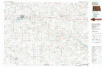
1981 Map of Dickinson
USGS Topo · Published 1981About this map
Dickinson serves as the focal point of this southwestern North Dakota landscape, situated along the Burlington Northern railroad and the Heart River. In the early 1980s, the community’s role as an educational and transit hub is evident through the presence of the State College and the Dickinson Municipal Airport. The surrounding terrain is defined by a series of prominent buttes, including Custer Lookout and Dobson Buttes, which punctuate the prairie between the winding courses of the Green River and Antelope Creek.
Find a feature on this map
49 named features on this map. Tap any name to fly to it.
Don’t see what you’re looking for? This feature index may not catch every label — zoom into the map to look around manually.
Map Details
Editions of this 1981 Dickinson Map
This is the sole edition of this map. No revisions or reprints were ever made.
Other maps of this area

1938 · Heart Butte
USGS Topo · 1:48,000

1944 · Heart Butte
USGS Topo · 1:62,500

1953 · Dickinson
USGS Topo · 1:250,000

1953 · Watford City
USGS Topo · 1:250,000

1954 · Bismarck
USGS Topo · 1:250,000

1954 · McClusky
USGS Topo · 1:250,000

1957 · Dickinson
USGS Topo · 1:250,000

1957 · Watford City
USGS Topo · 1:250,000

1958 · Bismarck
USGS Topo · 1:250,000

1958 · McClusky
USGS Topo · 1:250,000