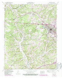
1953 Map of Dickson
USGS Topo · Published 1987About this map
Iron mines (Abandoned) located south of Dickson Lake reflect the industrial heritage of this region during a mid-century period of growth and transition. The area is physically defined by the Tennessee Valley Divide, where water systems like Yellow Creek and Piney River shape the terrain. This 1953 survey, later updated in the 1980s, captures the expansion of Dickson along the Seaboard railroad and the Broadway of America highway. Rural life is well-documented through numerous family-named landmarks such as Lamasters Cem, England Cem, and Redden Spring. The map also preserves the locations of local educational and religious centers including Hillcrest Sch, Coaling Sch, and New Hope Ch, alongside post-war infrastructure like the Dickson Municipal Airport and a Drive-in Theater.
Find a feature on this map
86 named features on this map. Tap any name to fly to it.
Don’t see what you’re looking for? This feature index may not catch every label — zoom into the map to look around manually.
Map Details
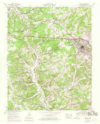
Editions of this 1953 Dickson Map
3 editions found

Other maps of this area

1901 · Colombia
USGS Topo · 1:125,000

1936 · Ruskin
USGS Topo · 1:24,000

1936 · Texas Hollow
USGS Topo · 1:24,000

1936 · Spot
USGS Topo · 1:24,000

1936 · Burns
USGS Topo · 1:24,000

1936 · Lyles
USGS Topo · 1:24,000

1936 · Tennessee City
USGS Topo · 1:24,000

1936 · Dickson
USGS Topo · 1:24,000
1952 · Spot
USGS Topo · 1:24,000
1952 · Texas Hollow
USGS Topo · 1:24,000