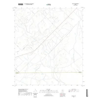
2019 Map of Dilley NE
USGS Topo · Published 2019About this map
The Frio River winds through this South Texas landscape, defining the topography of the region just north of the county line. The map captures the pastoral character of the area where the river meets local drainage systems like Lockhart Cr and Martin Br. A network of rural routes, including FM 1583 and several county roads such as Martin Branch Rd, connects the scattered ranchlands and agricultural tracts typical of this portion of the Rio Grande Plain. Near the southern boundary, the Burns Reservoir serves as a notable hydrologic feature, while the eastern edge is marked by the presence of Mule Cr. This survey provides a modern view of land use and water management in the brush country, illustrating how the natural waterways continue to dictate the placement of roads and property boundaries in a region defined by its reliance on intermittent water sources.
Find a feature on this map
13 named features on this map. Tap any name to fly to it.
Don’t see what you’re looking for? This feature index may not catch every label — zoom into the map to look around manually.
Map Details
Editions of this 2019 Dilley NE Map
This is the sole edition of this map. No revisions or reprints were ever made.
Other maps of this area

1925 · Pearsall 1-c
USGS Topo · 1:48,000

1927 · Pearsall
USGS Topo · 1:62,500

1934 · Schattel
USGS Topo · 1:62,500

1942 · Dilley
USGS Topo · 1:62,500

1953 · Crystal City
USGS Topo · 1:250,000

1955 · Crystal City
USGS Topo · 1:250,000

1956 · Hindes
USGS Topo · 1:62,500

1961 · Crystal City
USGS Topo · 1:250,000

1964 · Pearsall South
USGS Topo · 1:24,000
1964 · Derby
USGS Topo · 1:24,000