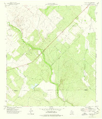
1974 Map of Dilley NE
USGS Topo · Published 1977About this map
The Frio River dominates this South Texas landscape, carving a meandering path through a region defined by its waterway network and industrial extraction. Topographic data from 1973 reveals a terrain shaped by the confluence of Lockhart Creek, Mule Creek, and Martin Branch. The presence of a Gravel Pit and larger Gravel Pits along the riverbanks suggests a local economy tied to the land's geological resources. Spanning the county line between Frio County and La Salle County, the map documents a sparse, rural environment where an Indefinite Boundary reflects the complexities of surveying this brush-country territory. This record captures the area's transition between agricultural uses and light industrial mining during the mid-1970s.
Find a feature on this map
8 named features on this map. Tap any name to fly to it.
Don’t see what you’re looking for? This feature index may not catch every label — zoom into the map to look around manually.
Map Details
Editions of this 1974 Dilley NE Map
This is the sole edition of this map. No revisions or reprints were ever made.
Other maps of this area

1925 · Pearsall 1-c
USGS Topo · 1:48,000

1927 · Pearsall
USGS Topo · 1:62,500

1934 · Schattel
USGS Topo · 1:62,500

1942 · Dilley
USGS Topo · 1:62,500

1953 · Crystal City
USGS Topo · 1:250,000

1955 · Crystal City
USGS Topo · 1:250,000

1956 · Hindes
USGS Topo · 1:62,500

1961 · Crystal City
USGS Topo · 1:250,000

1964 · Pearsall South
USGS Topo · 1:24,000
1964 · Derby
USGS Topo · 1:24,000