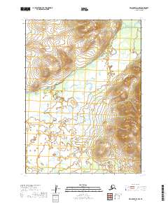
2019 Map of Dillingham D-1 NW
USGS Topo · Published 2019About this map
The Koktuli River winds through this expanse of the Dillingham Census Area, shaping a landscape defined by braided river systems and low-lying wetlands. The waterway's path across the northern half of the sheet provides a detailed record of the alluvial patterns typical of this region of Alaska. To the north, the terrain ascends toward the Jack Rabbit Hills, which serve as a prominent topographical boundary overlooking the river valley. The southern portion of the quadrangle is dominated by the tributaries of Pike Cr, where numerous small lakes and ponds collect in the flat, low-elevation basins. This 2019 survey documents a largely roadless interior, emphasizing the natural drainage networks that dictate movement and seasonal access through the remote backcountry.
Find a feature on this map
7 named features on this map. Tap any name to fly to it.
Don’t see what you’re looking for? This feature index may not catch every label — zoom into the map to look around manually.
Map Details
Editions of this 2019 Dillingham D-1 NW Map
This is the sole edition of this map. No revisions or reprints were ever made.
Other maps of this area

1950 · Taylor Mountains
USGS Topo · 1:250,000

1951 · Taylor Mountains
USGS Topo · 1:250,000

1951 · Dillingham
USGS Topo · 1:250,000

1954 · Taylor Mountains
USGS Topo · 1:250,000

1954 · Dillingham
USGS Topo · 1:250,000

1954 · Dillingham D-2
USGS Topo · 1:63,360

1954 · Taylor Mountains A-2
USGS Topo · 1:63,360

1954 · Dillingham D-1
USGS Topo · 1:63,360
1954 · Taylor Mountains A-1
USGS Topo · 1:63,360
2019 · Dillingham D-2 NE
USGS Topo · 1:25,000