
1954 Map of Taylor Mountains A-2
USGS Topo · Published 1968About this map
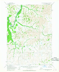
The vast, water-heavy landscape of the Taylor Mountains (A-2) region comes into focus through this mid-century survey. The terrain is defined by a dense network of small lakes and ponds, drained by Old Man Creek, Ethel Creek, and Dixie Creek. A prominent River winds along the eastern and southern edges of the quadrangle, where the only signs of human habitation are several scattered Cabins. This map captures a remote area of Alaska during the 1950s, a period when photogrammetric methods from aerial photography were first being used by the Army Map Service to document the Seward Meridian. The presence of the Base Line running through the center of the sheet indicates the foundational surveying work required for land management in this unsurveyed territory.
Find a feature on this map
6 named features on this map. Tap any name to fly to it.
Don’t see what you’re looking for? This feature index may not catch every label — zoom into the map to look around manually.
Map Details
Editions of this 1954 Taylor Mountains A-2 Map
This is the sole edition of this map. No revisions or reprints were ever made.
Other maps of this area

1950 · Taylor Mountains
USGS Topo · 1:250,000

1951 · Taylor Mountains
USGS Topo · 1:250,000

1951 · Dillingham
USGS Topo · 1:250,000

1954 · Taylor Mountains
USGS Topo · 1:250,000

1954 · Dillingham
USGS Topo · 1:250,000
1954 · Taylor Mountains B-2
USGS Topo · 1:63,360

1954 · Dillingham D-2
USGS Topo · 1:63,360

1954 · Taylor Mountains B-1
USGS Topo · 1:63,360

1954 · Dillingham D-3
USGS Topo · 1:63,360

1954 · Dillingham D-1
USGS Topo · 1:63,360