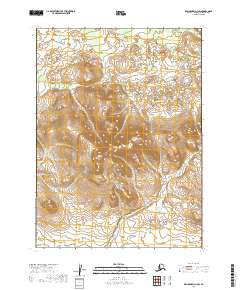
2019 Map of Dillingham D-1 SW
USGS Topo · Published 2019About this map
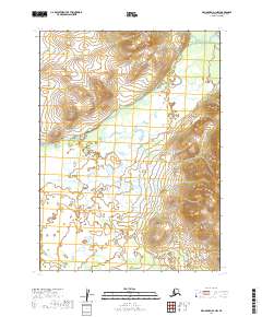
The remote interior of the Dillingham Census Area is characterized by significant elevation changes and a dense network of seasonal drainages. Pike Cr flows through the northern reaches of this terrain, cutting through the high country where peaks reach several thousand feet. This 2019 survey documents the extensive township and range system utilized by the Bureau of Land Management to organize this vast territory, including portions of t3s r41w and t4s r41w. The landscape is dominated by steep contours and isolated water bodies, reflecting a wilderness region devoid of established roads or permanent settlements at the time of this mapping.
Find a feature on this map
7 named features on this map. Tap any name to fly to it.
Don’t see what you’re looking for? This feature index may not catch every label — zoom into the map to look around manually.
Map Details
Editions of this 2019 Dillingham D-1 SW Map
This is the sole edition of this map. No revisions or reprints were ever made.
Other maps of this area

1951 · Dillingham
USGS Topo · 1:250,000

1954 · Dillingham
USGS Topo · 1:250,000

1954 · Dillingham D-2
USGS Topo · 1:63,360

1954 · Dillingham C-1
USGS Topo · 1:63,360

1954 · Dillingham C-2
USGS Topo · 1:63,360

1954 · Dillingham D-1
USGS Topo · 1:63,360
2019 · Dillingham D-2 NE
USGS Topo · 1:25,000
2019 · Dillingham D-2 SE
USGS Topo · 1:25,000
2019 · Dillingham D-1 SE
USGS Topo · 1:25,000
2019 · Dillingham D-1 NW
USGS Topo · 1:25,000