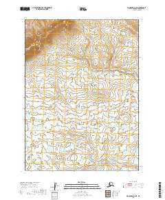
2019 Map of Dillingham D-3 NE
USGS Topo · Published 2019About this map
The northern reaches of the Bristol Bay region are defined by an intricate network of wetlands and ponds within T2s R45w and T2s R44w. This 2019 survey documents a landscape of dramatic contrast, where the relatively flat, water-saturated lowlands of T3s R44w meet the rising elevations of the north. The survey accurately preserves the Public Land Survey System boundaries, including T3s R45w, marking out the township and range divisions that structure this part of the Dillingham Census Area. The lack of named roads or established settlements reflects the remote, natural state of this terrain, highlighting the glacial and fluvial processes that have shaped this specific Alaskan quadrangle.
Find a feature on this map
4 named features on this map. Tap any name to fly to it.
Don’t see what you’re looking for? This feature index may not catch every label — zoom into the map to look around manually.
Map Details
Editions of this 2019 Dillingham D-3 NE Map
This is the sole edition of this map. No revisions or reprints were ever made.
Other maps of this area

1950 · Taylor Mountains
USGS Topo · 1:250,000

1951 · Taylor Mountains
USGS Topo · 1:250,000

1951 · Dillingham
USGS Topo · 1:250,000

1954 · Taylor Mountains
USGS Topo · 1:250,000

1954 · Dillingham
USGS Topo · 1:250,000

1954 · Dillingham D-2
USGS Topo · 1:63,360

1954 · Dillingham D-3
USGS Topo · 1:63,360

1954 · Taylor Mountains A-2
USGS Topo · 1:63,360
1954 · Taylor Mountains A-3
USGS Topo · 1:63,360
2019 · Dillingham D-3 SE
USGS Topo · 1:25,000