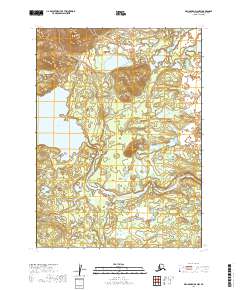
2019 Map of Dillingham D-6 NW
USGS Topo · Published 2019About this map
Tikchik Lake anchors the western portion of this 2019 survey, where the deep waters of the glacial lake basin transition into the headwaters of the Nuyakuk River. The landscape is defined by the sharp descent at Tikchik Falls, a natural obstruction that characterizes the drainage of the Tikchik system. This region of southwest Alaska is shown as an undeveloped wilderness, primarily valued for its complex hydrography and intricate shorelines.
Find a feature on this map
7 named features on this map. Tap any name to fly to it.
Don’t see what you’re looking for? This feature index may not catch every label — zoom into the map to look around manually.
Map Details
Editions of this 2019 Dillingham D-6 NW Map
This is the sole edition of this map. No revisions or reprints were ever made.
Other maps of this area

1950 · Taylor Mountains
USGS Topo · 1:250,000

1951 · Taylor Mountains
USGS Topo · 1:250,000

1951 · Dillingham
USGS Topo · 1:250,000

1954 · Taylor Mountains
USGS Topo · 1:250,000

1954 · Dillingham
USGS Topo · 1:250,000

1954 · Dillingham D-6
USGS Topo · 1:63,360

1954 · Dillingham D-7
USGS Topo · 1:63,360

1954 · Taylor Mountains A-6
USGS Topo · 1:63,360
1954 · Taylor Mountains A-7
USGS Topo · 1:63,360
2019 · Dillingham D-6 NE
USGS Topo · 1:25,000