
1955 Map of Dillon
USGS Topo · Published 1978About this map
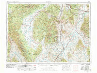
The Continental Divide snake through this expansive mid-century survey of southwest Montana and eastern Idaho, marking the high crest of the Beaverhead Mountains and Anaconda Range. The landscape is dominated by the sprawling headwaters of the Missouri River system, where the Big Hole River and Beaverhead River carve wide valleys between the Pioneer Mountains and the Ruby Range. Historic mining and pioneer settlements like Bannack and Argenta sit tucked into the foothills, while the town of Dillon serves as a central hub for the Union Pacific rail lines and regional roads. To the west, the Big Hole Battlefield Nat Mon preserves the site of the 1877 conflict within the Big Hole basin. Large-scale water management is evident in the presence of the Ruby River Reservoir and the Clark Canyon Reservoir, reflecting the region's long-standing reliance on irrigation and ranching.
Find a feature on this map
91 named features on this map. Tap any name to fly to it.
Don’t see what you’re looking for? This feature index may not catch every label — zoom into the map to look around manually.
Map Details
Editions of this 1955 Dillon Map
2 editions found
Other maps of this area

1886 · Fort Logan
USGS Topo · 1:250,000

1888 · Three Forks
USGS Topo · 1:250,000

1889 · Helena
USGS Topo · 1:250,000

1893 · Helena
USGS Topo · 1:250,000

1893 · Dillon
USGS Topo · 1:250,000

1894 · Three Forks
USGS Topo · 1:250,000

1895 · Three Forks
USGS Topo · 1:250,000

1899 · Boulder
USGS Topo · 1:125,000

1899 · Helena
USGS Topo · 1:250,000

1901 · Hamilton
USGS Topo · 1:125,000