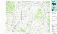
1983 Map of Dillon
USGS Topo · Published 1983About this map
The Beaverhead River and Ruby River valleys define this 1983 study of southwestern Montana, where the ranching hub of Dillon serves as the focal point for a landscape shaped by mining and water management. To the west, the Pioneer Mountains harbor a dense network of mineral claims, including the Argenta Mine and Legal Tender Mine near the settlement of Argenta. This area also includes the historic territorial capital at Bannack along Grasshopper Creek, illustrating the transition from early gold camps to established ranching districts.
Find a feature on this map
95 named features on this map. Tap any name to fly to it.
Don’t see what you’re looking for? This feature index may not catch every label — zoom into the map to look around manually.
Map Details
Editions of this 1983 Dillon Map
This is the sole edition of this map. No revisions or reprints were ever made.
Other maps of this area

1888 · Three Forks
USGS Topo · 1:250,000

1893 · Dillon
USGS Topo · 1:250,000

1894 · Three Forks
USGS Topo · 1:250,000

1895 · Three Forks
USGS Topo · 1:250,000

1947 · Bozeman
USGS Topo · 1:250,000

1948 · Bozeman
USGS Topo · 1:250,000

1949 · Varney
USGS Topo · 1:62,500

1950 · Harrison
USGS Topo · 1:62,500

1950 · Virginia City
USGS Topo · 1:62,500

1950 · Monument Ridge
USGS Topo · 1:62,500