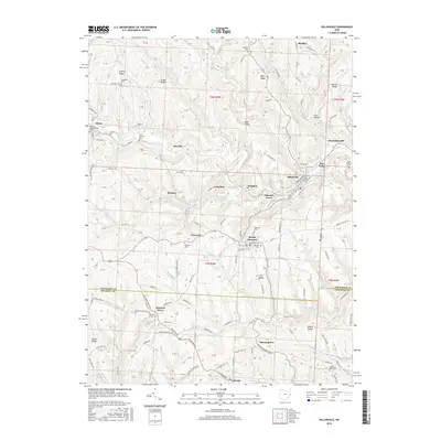
2016 Map of Dillonvale
USGS Topo · Published 2016About this map
The hills of Jefferson and Belmont counties are deeply carved by Short Creek and its many tributaries, defining the layout of historic coal and farming communities. In the north, Adena and Dillonvale serve as focal points for local commerce, while smaller hamlets like Herrick, Ramsey, and Dunglen mark the winding creek valleys. The legacy of extraction is evident at the Dunglen Mine Impoundment and Dorothy Mine Pond, which occupy the spaces between agricultural ridges like Cherry Ridge and Brier Ridge. This 2016 survey documents a dense network of family and community history, particularly through its numerous cemeteries, including Saint Casimirs Cem and the Hicksite Cem. The transition from river-bottom settlements to high-ridge farms like those near Morningview reflects the enduring topography of the Ohio hill country.
Find a feature on this map
171 named features on this map. Tap any name to fly to it.
Don’t see what you’re looking for? This feature index may not catch every label — zoom into the map to look around manually.
Map Details
Editions of this 2016 Dillonvale Map
This is the sole edition of this map. No revisions or reprints were ever made.
Other maps of this area

1901 · Cadiz
USGS Topo · 1:62,500

1902 · Wheeling
USGS Topo · 1:62,500

1903 · Cadiz
USGS Topo · 1:62,500

1904 · Steubenville
USGS Topo · 1:62,500

1905 · St. Clairsville
USGS Topo · 1:62,500

1935 · Wheeling
USGS Topo · 1:62,500

1935 · Steubenville
USGS Topo · 1:62,500

1942 · Wheeling
USGS Topo · 1:62,500

1942 · Steubenville
USGS Topo · 1:62,500

1951 · Canton
USGS Topo · 1:250,000