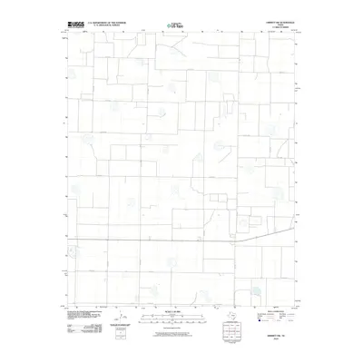
2010 Map of Dimmitt SW
USGS Topo · Published 2010About this map
The High Plains of Castro County are defined here by a rigid grid of agricultural section lines and farm-to-market roads, illustrating the systematic land organization of the Texas Panhandle. Extensive networks like Co Rd 610 and Co Rd 505 traverse a landscape dotted with numerous natural depressions or playa lakes, which serve as critical drainage and ecological points in this semi-arid environment. The infrastructure is anchored by primary thoroughfares such as Fm 1555 and Fm 2392, which connect the scattered rural homesteads and agricultural operations to the larger regional economy. This 2010 survey by the U.S. Geological Survey utilizes NAIP imagery from 2008 to depict the persistent geometry of the Panhandle's ranching and farming heritage, where every mile road, such as Co Rd 614, marks a boundary of local history and land ownership.
Find a feature on this map
15 named features on this map. Tap any name to fly to it.
Don’t see what you’re looking for? This feature index may not catch every label — zoom into the map to look around manually.
Map Details
Editions of this 2010 Dimmitt SW Map
This is the sole edition of this map. No revisions or reprints were ever made.
Other maps of this area

1954 · Clovis
USGS Topo · 1:250,000

1958 · Clovis
USGS Topo · 1:250,000

1962 · Dodd NE
USGS Topo · 1:24,000

1963 · Flagg
USGS Topo · 1:24,000

1963 · Lazbuddie
USGS Topo · 1:24,000

1965 · Dimmitt
USGS Topo · 1:24,000

1965 · Dimmitt SW
USGS Topo · 1:24,000

1965 · Tam Anne
USGS Topo · 1:24,000

1966 · Jumbo
USGS Topo · 1:24,000

1966 · Easter
USGS Topo · 1:24,000