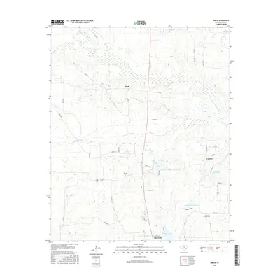
2016 Map of Dimple
USGS Topo · Published 2016About this map
Pecan Bayou and White Oak Bayou meander through this north Texas landscape, defining a terrain shaped by the complex hydrology of Red River County. The settlement of Dimple sits at a rural crossroads, while the northern reaches of Clarksville extend into the southern portion of the map. This area is notably dense with small, family-named burial grounds that provide vital links for local genealogy, including Stone Chapel Cem, Whitemans Chapel Cem, and Hopewell Cem. The landscape is further defined by modern conservation efforts, evidenced by a series of reservoirs like Soil Conservation Service Site 3 Reservoir. To the east, the area around Arrowhead Ranch Lake and the Country Club suggests a shift toward recreational land use amidst the traditional ranching and timber geography of the region.
Find a feature on this map
61 named features on this map. Tap any name to fly to it.
Don’t see what you’re looking for? This feature index may not catch every label — zoom into the map to look around manually.
Map Details
Editions of this 2016 Dimple Map
This is the sole edition of this map. No revisions or reprints were ever made.
Other maps of this area

1950 · Acworth
USGS Topo · 1:24,000

1950 · White Rock
USGS Topo · 1:24,000

1950 · Annona
USGS Topo · 1:24,000

1951 · Annona
USGS Topo · 1:24,000

1951 · White Rock
USGS Topo · 1:24,000

1951 · Acworth
USGS Topo · 1:24,000

1951 · Negley
USGS Topo · 1:24,000

1951 · Manchester
USGS Topo · 1:24,000

1953 · Texarkana
USGS Topo · 1:250,000

1956 · Texarkana
USGS Topo · 1:250,000