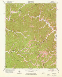
1962 Map of Dingus
USGS Topo · Published 1976About this map
Dingus and the surrounding hollows of Morgan and Magoffin counties are defined by a complex network of creeks and ridge-top settlements in this early 1960s revision. The landscape is dominated by the narrow valleys of Paint Creek and Fannins Fork, where small communities like Crockett and Moon are situated alongside country churches such as New Salem Ch and Sulphur Spring Ch. Evidence of the region's extraction economy is visible through multiple Strip Mines and scattered Oil Wells, particularly in the northwestern reaches near Deadly Branch.
Find a feature on this map
74 named features on this map. Tap any name to fly to it.
Don’t see what you’re looking for? This feature index may not catch every label — zoom into the map to look around manually.
Map Details
Editions of this 1962 Dingus Map
4 editions found
Other maps of this area

1886 · Prestonsburg
USGS Topo · 1:125,000

1889 · Salyersville
USGS Topo · 1:125,000

1891 · Salyersville
USGS Topo · 1:125,000

1892 · Prestonsburg
USGS Topo · 1:125,000

1899 · Salyersville
USGS Topo · 1:125,000

1903 · Kenova
USGS Topo · 1:125,000

1904 · Kenova
USGS Topo · 1:125,000

1915 · Paintsville
USGS Topo · 1:48,000

1917 · Paintsville
USGS Topo · 1:62,500

1950 · Isonville
USGS Topo · 1:24,000