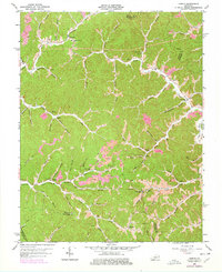
1962 Map of Dingus
USGS Topo · Published 1978About this map
Crockett and Moon anchor a landscape defined by the branching waterways of the Cumberland Plateau in this mid-century survey. The terrain is marked by the distinct cultural and industrial footprint of eastern Kentucky, where pipelines and extensive strip mines coexist with rural institutions like the White Oak School and Union Church. Waterways such as Paint Creek and the Open Fork carve deep through the region, creating a network of ridges and hollows that historically dictated settlement patterns. Family and community history is etched into the map through numerous small burial grounds and landmarks like Peddler Gap and Petes Cave. The presence of several oil wells and mines highlights the extractive economy of the era, while the many cemeteries, including the Ferguson Cemetery and Conley Cemetery, provide specific locations for genealogical research within Morgan County.
Find a feature on this map
77 named features on this map. Tap any name to fly to it.
Don’t see what you’re looking for? This feature index may not catch every label — zoom into the map to look around manually.
Map Details
Editions of this 1962 Dingus Map
4 editions found
Other maps of this area

1886 · Prestonsburg
USGS Topo · 1:125,000

1889 · Salyersville
USGS Topo · 1:125,000

1891 · Salyersville
USGS Topo · 1:125,000

1892 · Prestonsburg
USGS Topo · 1:125,000

1899 · Salyersville
USGS Topo · 1:125,000

1903 · Kenova
USGS Topo · 1:125,000

1904 · Kenova
USGS Topo · 1:125,000

1915 · Paintsville
USGS Topo · 1:48,000

1917 · Paintsville
USGS Topo · 1:62,500

1950 · Isonville
USGS Topo · 1:24,000