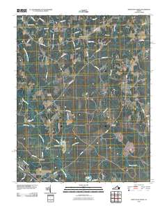
2010 Map of Disputanta North
USGS Topo · Published 2010About this map
Garysville and the rural stretches of Prince George County are meticulously detailed in this 2010 topographic record. The landscape is defined by the complex drainage systems of the Blackwater Swamp and the North Fork Blackwater Swamp, which feed into numerous tributaries such as Walls Run, Mike Run, and Cattail Creek. The map documents a traditional Virginia rural pattern where commerce and community centered on small hubs and family-owned establishments, visible through labels like Cummings Store, Seldons Store, and Binford Store.
Find a feature on this map
58 named features on this map. Tap any name to fly to it.
Don’t see what you’re looking for? This feature index may not catch every label — zoom into the map to look around manually.
Map Details
Editions of this 2010 Disputanta North Map
This is the sole edition of this map. No revisions or reprints were ever made.
Other maps of this area

1894 · Bermuda Hundred
USGS Topo · 1:62,500

1894 · Petersburg
USGS Topo · 1:62,500

1918 · Charles City
USGS Topo · 1:62,500

1919 · Disputanta
USGS Topo · 1:62,500

1943 · Savedge
USGS Topo · 1:31,680

1943 · Hopewell
USGS Topo · 1:31,680

1943 · Disputanta
USGS Topo · 1:31,680

1943 · Richmond
USGS Topo · 1:250,000

1944 · Waverly
USGS Topo · 1:31,680
1944 · Nebletts Mill
USGS Topo · 1:31,680