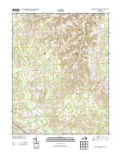
2013 Map of Disputanta North
USGS Topo · Published 2013About this map
Garysville and the surrounding Prince George County landscape are defined by a complex network of slow-moving waterways and wetland systems. This region, south of the James River, is dominated by the N Fork Blackwater Swamp and the primary Blackwater Swamp, which converge near Hitchcock. The settlement pattern follows the higher ground between these drainages, with Newville situated along the eastern corridor and Disputanta at the southern edge. Local landmarks like Hitchcock Bridge and Lake Binford mark the few established crossings and water features within this low-lying terrain. The road network, including the historic Old Stage Rd and Pole Run Rd, illustrates how transportation evolved around the numerous runs and creeks, such as Mike Run and Cattail Cr, which eventually feed into the expansive Otterdam Swamp to the southeast.
Find a feature on this map
59 named features on this map. Tap any name to fly to it.
Don’t see what you’re looking for? This feature index may not catch every label — zoom into the map to look around manually.
Map Details
Editions of this 2013 Disputanta North Map
This is the sole edition of this map. No revisions or reprints were ever made.
Other maps of this area

1894 · Bermuda Hundred
USGS Topo · 1:62,500

1894 · Petersburg
USGS Topo · 1:62,500

1918 · Charles City
USGS Topo · 1:62,500

1919 · Disputanta
USGS Topo · 1:62,500

1943 · Savedge
USGS Topo · 1:31,680

1943 · Hopewell
USGS Topo · 1:31,680

1943 · Disputanta
USGS Topo · 1:31,680

1943 · Richmond
USGS Topo · 1:250,000

1944 · Waverly
USGS Topo · 1:31,680
1944 · Nebletts Mill
USGS Topo · 1:31,680