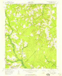
1956 Map of Disputanta North
USGS Topo · Published 1958About this map
Disputanta anchors the southern edge of this mid-century landscape, where the Norfolk and Western railway cuts through the lowlands of Second Swamp. The terrain is defined by a dense network of slow-moving waterways including Blackwater Swamp and Powell Creek, which carve through the timbered reaches of Prince George County. Historically significant landmarks such as the National Moorish Home and the Old Academy Sch suggest a settled rural community with deep roots. Cultural life is further evidenced by several country congregations, including Bethlehem Ch and Lebanon Ch. Near the center of the sheet, Lake Binford and its namesake Binford Store mark a local hub of activity, while the north is bounded by the small community of Garysville. This survey captures a rural Virginia landscape transitioning into the late 1950s, preserving the locations of family-owned businesses like Seldons Store and crossings such as Hitchcock Bridge.
Find a feature on this map
28 named features on this map. Tap any name to fly to it.
Don’t see what you’re looking for? This feature index may not catch every label — zoom into the map to look around manually.
Map Details
Editions of this 1956 Disputanta North Map
This is the sole edition of this map. No revisions or reprints were ever made.
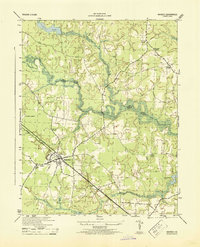
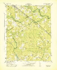
Other maps of this area

1894 · Bermuda Hundred
USGS Topo · 1:62,500

1894 · Petersburg
USGS Topo · 1:62,500

1918 · Charles City
USGS Topo · 1:62,500

1919 · Disputanta
USGS Topo · 1:62,500

1943 · Savedge
USGS Topo · 1:31,680

1943 · Hopewell
USGS Topo · 1:31,680

1943 · Disputanta
USGS Topo · 1:31,680

1943 · Richmond
USGS Topo · 1:250,000
1944 · Waverly
USGS Topo · 1:31,680
1944 · Nebletts Mill
USGS Topo · 1:31,680