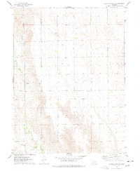
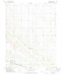
1974 Map of Dittons Creek SE
USGS Topo · Published 1977About this map
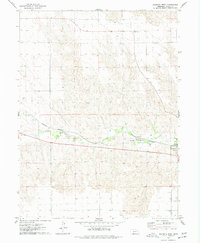
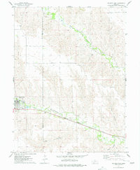
Stinking Water Creek carves a path through the high plains along the border of Chase and Hayes counties, defining a landscape of canyons and agricultural tablelands in the mid-1970s. The drainage of Cliff Dwellers Canyon highlights the area's distinctive topography, where numerous wells dot the sections, indicating the critical role of groundwater in this western Nebraska region. Small, isolated landmarks like a sandpit and a local substation reflect the modest infrastructure of the rural economy.
Find a feature on this map
8 named features on this map. Tap any name to fly to it.
Don’t see what you’re looking for? This feature index may not catch every label — zoom into the map to look around manually.
Map Details
Editions of this 1974 Dittons Creek SE Map
This is the sole edition of this map. No revisions or reprints were ever made.
Other maps of this area

1954 · McCook
USGS Topo · 1:250,000

1957 · McCook
USGS Topo · 1:250,000

1958 · McCook
USGS Topo · 1:250,000
1973 · Dittons Creek NE
USGS Topo · 1:24,000
1973 · Dittons Creek NW
USGS Topo · 1:24,000
1973 · Hayes Center NW
USGS Topo · 1:24,000
1974 · Hamlet
USGS Topo · 1:24,000
1974 · Wauneta West
USGS Topo · 1:24,000
1974 · Dittons Creek
USGS Topo · 1:24,000
1974 · Wauneta East
USGS Topo · 1:24,000