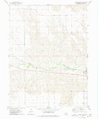
1974 Map of Wauneta West
USGS Topo · Published 1977About this map
Frenchman Creek carves a fertile valley through the high plains of Chase County, defining the agricultural and transit corridor of this western Nebraska landscape. The village of Wauneta sits at the eastern edge of the survey, where the valley floor widens to accommodate both the townsite and the Burlington Northern railroad line that follows the watercourse. This rail connection was historically vital for moving grain and cattle from the surrounding uplands to distant markets.
Find a feature on this map
7 named features on this map. Tap any name to fly to it.
Don’t see what you’re looking for? This feature index may not catch every label — zoom into the map to look around manually.
Map Details
Editions of this 1974 Wauneta West Map
This is the sole edition of this map. No revisions or reprints were ever made.
Other maps of this area

1954 · McCook
USGS Topo · 1:250,000

1957 · McCook
USGS Topo · 1:250,000

1958 · McCook
USGS Topo · 1:250,000

1973 · Enders
USGS Topo · 1:24,000

1973 · Ough
USGS Topo · 1:24,000

1973 · Wauneta SW
USGS Topo · 1:24,000

1973 · Wauneta SE
USGS Topo · 1:24,000

1973 · Imperial Municipal Airport
USGS Topo · 1:24,000

1974 · Dittons Creek SE
USGS Topo · 1:24,000
1974 · Dittons Creek
USGS Topo · 1:24,000