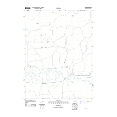
2010 Map of Dixon
USGS Topo · Published 2010About this map
The Little Snake River meanders across the southern portion of this region, shaping the agricultural and industrial landscape near the settlement of Dixon. Irrigation infrastructure is central to the area's development, evidenced by the First Mesa Ditch and the West Side Canal that follow the river valley. To the north, the terrain rises toward Muddy Mountain and Red Monument, revealing a history of resource extraction with the Cut-off Gulch Opening Mine and Coal Gulch Opening Mine situated along the draws.
Find a feature on this map
32 named features on this map. Tap any name to fly to it.
Don’t see what you’re looking for? This feature index may not catch every label — zoom into the map to look around manually.
Map Details
Editions of this 2010 Dixon Map
This is the sole edition of this map. No revisions or reprints were ever made.
Other maps of this area

1916 · Craig
USGS Topo · 1:125,000

1932 · Savery
USGS Topo · 1:96,000

1940 · Savery
USGS Topo · 1:125,000

1954 · Rawlins
USGS Topo · 1:250,000

1954 · Craig
USGS Topo · 1:250,000

1957 · Craig
USGS Topo · 1:250,000

1957 · Baggs
USGS Topo · 1:62,500

1958 · Rawlins
USGS Topo · 1:250,000

1958 · Craig
USGS Topo · 1:250,000

1960 · Craig
USGS Topo · 1:250,000