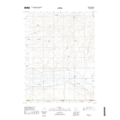
2018 Map of Dixon
USGS Topo · Published 2018About this map
Dixon sits at the southern edge of Carbon County along the Little Snake River, serving as a focal point for this high-desert landscape near the Wyoming-Colorado border. The settlement is surrounded by a complex system of irrigation and water management, including the W Side Canal and First Mesa Ditch, which support local ranching in the river valley. The terrain is defined by dramatic elevations and depressions, from the heights of Muddy Mtn and Dolan Mesa to the winding paths of Coal Mine Draw and Hicox Draw.
Find a feature on this map
38 named features on this map. Tap any name to fly to it.
Don’t see what you’re looking for? This feature index may not catch every label — zoom into the map to look around manually.
Map Details
Editions of this 2018 Dixon Map
This is the sole edition of this map. No revisions or reprints were ever made.
Other maps of this area

1916 · Craig
USGS Topo · 1:125,000

1932 · Savery
USGS Topo · 1:96,000

1940 · Savery
USGS Topo · 1:125,000

1954 · Rawlins
USGS Topo · 1:250,000

1954 · Craig
USGS Topo · 1:250,000

1957 · Craig
USGS Topo · 1:250,000

1957 · Baggs
USGS Topo · 1:62,500

1958 · Rawlins
USGS Topo · 1:250,000

1958 · Craig
USGS Topo · 1:250,000

1960 · Craig
USGS Topo · 1:250,000