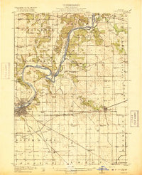
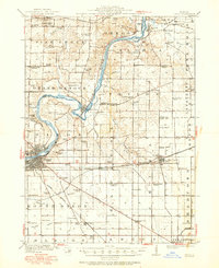
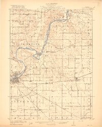
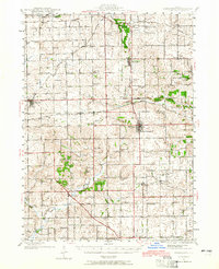
1918 Map of Dixon
USGS Topo · Published 1918About this map
The Rock River carves a dramatic oxbow at Grand Detour, a geographic focal point of this northern Illinois landscape just before the end of the Great War. This survey captures a dense network of early 20th-century rural infrastructure, characterized by an exceptional number of small district schoolhouses such as Whiteoak School, Nashua School, and the Harmony Hill School. The regional economy is anchored by the hub of Dixon and smaller rail-dependent villages like Franklin Grove and Nachusa.
Find a feature on this map
86 named features on this map. Tap any name to fly to it.
Don’t see what you’re looking for? This feature index may not catch every label — zoom into the map to look around manually.
Map Details
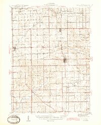
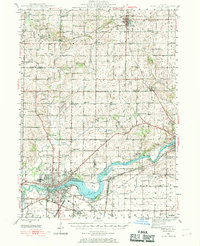
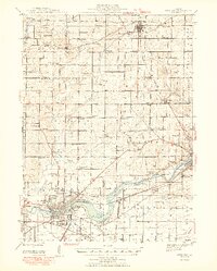
Editions of this 1918 Dixon Map
3 editions found
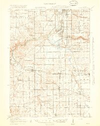
Other maps of this area

1917 · Kings
USGS Topo · 1:62,500
1918 · Dixon
USGS Topo · 1:62,500
1918 · Kings
USGS Topo · 1:62,500

1922 · Oregon
USGS Topo · 1:62,500

1924 · Oregon
USGS Topo · 1:62,500

1930 · Woodsung
USGS Topo · 1:48,000
1942 · Forreston
USGS Topo · 1:62,500
1945 · Forreston
USGS Topo · 1:62,500
1946 · Sterling
USGS Topo · 1:62,500
1948 · Sterling
USGS Topo · 1:62,500
Featured Places
- Dixon, Dixon Township
- Oregon, Oregon - Nashua Township
- Amboy, Amboy Township
- Franklin Grove, Franklin Grove Township
- Grand Detour, Grand Detour Township