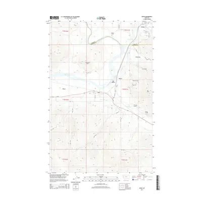
2014 Map of Dixon
USGS Topo · Published 2014About this map
The confluence of the Flathead River and the Jocko River anchors this landscape, where mountain ridges and valleys converge along the border of Lake and Sanders counties. The settlement of Dixon sits south of the Flathead, serving as a hub for local roads like Bench Rd and MT-200. Further north, Moiese occupies the Moiese Valley, while the distinct historic sites of Old Agency and Agency are situated near the banks of the Jocko.
Find a feature on this map
51 named features on this map. Tap any name to fly to it.
Don’t see what you’re looking for? This feature index may not catch every label — zoom into the map to look around manually.
Map Details
Editions of this 2014 Dixon Map
This is the sole edition of this map. No revisions or reprints were ever made.
Other maps of this area

1956 · Wallace
USGS Topo · 1:250,000

1959 · Alberton
USGS Topo · 1:62,500

1959 · Arlee
USGS Topo · 1:62,500

1960 · Wallace
USGS Topo · 1:250,000

1964 · Dixon
USGS Topo · 1:24,000

1964 · Mc Donald
USGS Topo · 1:24,000

1964 · Melton Ranch
USGS Topo · 1:24,000

1964 · Ravalli
USGS Topo · 1:24,000

1965 · Sloan
USGS Topo · 1:24,000
1965 · Charlo
USGS Topo · 1:24,000