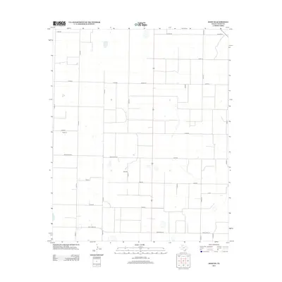
2012 Map of Dodd NE
USGS Topo · Published 2012About this map
Flagg Cem provides a central historical reference point in this corner of Castro County, set amidst a landscape defined by an orderly grid of rural transport routes. The transition from county-maintained dirt and gravel paths like Co Rd-620 and Co Rd-511 to more established thoroughfares like Ranch Road 1524 and Ranch Road 145 illustrates the modern agricultural infrastructure of the Texas Panhandle. This 2012 survey captures the geometry of the High Plains, where scattered depressions and intermittent water catchments are the only breaks in the extensive system of property lines and access roads. The prevalence of numeric road designations, such as Road 511 and Road 622, reflects a systematic approach to rural navigation and land management at the start of the twenty-first century.
Find a feature on this map
22 named features on this map. Tap any name to fly to it.
Don’t see what you’re looking for? This feature index may not catch every label — zoom into the map to look around manually.
Map Details
Editions of this 2012 Dodd NE Map
This is the sole edition of this map. No revisions or reprints were ever made.
Other maps of this area

1954 · Clovis
USGS Topo · 1:250,000

1958 · Clovis
USGS Topo · 1:250,000

1962 · Dodd NE
USGS Topo · 1:24,000

1963 · Flagg
USGS Topo · 1:24,000

1963 · Hart NW
USGS Topo · 1:24,000

1963 · Dodd SE
USGS Topo · 1:24,000

1963 · Dodd
USGS Topo · 1:24,000

1963 · Hart SW
USGS Topo · 1:24,000

1965 · Dimmitt
USGS Topo · 1:24,000

1965 · Dimmitt SW
USGS Topo · 1:24,000