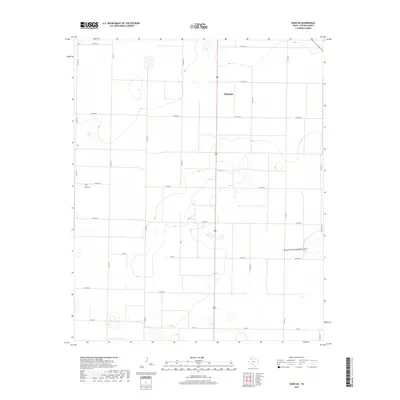
2019 Map of Dodd NE
USGS Topo · Published 2019About this map
Dimmitt anchors the northeastern portion of this High Plains landscape, a region defined by its vast agricultural grid and a network of county roads. The terrain is marked by subtle depressions and the meandering path of the North Fork Running Water Draw, which cuts across the lower-eastern quadrant. This survey reflects the modern rural infrastructure of Castro County, where farm-to-market routes like Fm 145 and numerous section roads, including Co Rd 618 and Co RD 510, facilitate the movement of goods in a ranching and farming economy. For those researching local burial sites or genealogical roots, the Flagg Cem sits near the western edge of the quadrangle, serving as a quiet landmark amidst the expansive fields. The map provides a clear view of the land's surface drainage and the systematic division of territory that has shaped the Texas Panhandle.
Find a feature on this map
19 named features on this map. Tap any name to fly to it.
Don’t see what you’re looking for? This feature index may not catch every label — zoom into the map to look around manually.
Map Details
Editions of this 2019 Dodd NE Map
This is the sole edition of this map. No revisions or reprints were ever made.
Other maps of this area

1954 · Clovis
USGS Topo · 1:250,000

1958 · Clovis
USGS Topo · 1:250,000

1962 · Dodd NE
USGS Topo · 1:24,000

1963 · Flagg
USGS Topo · 1:24,000

1963 · Hart NW
USGS Topo · 1:24,000

1963 · Dodd SE
USGS Topo · 1:24,000

1963 · Dodd
USGS Topo · 1:24,000

1963 · Hart SW
USGS Topo · 1:24,000

1965 · Dimmitt
USGS Topo · 1:24,000

1965 · Dimmitt SW
USGS Topo · 1:24,000