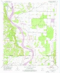
1952 Map of Doddridge SE
USGS Topo · Published 1976About this map
The Red River and Sulphur River converge in this riverine landscape straddling the Arkansas Louisiana border. In the early 1950s, the local economy and transport revolved around these shifting waterways, evidenced by the Spring Bank Ferry and Missionary Ferry crossing points. The floodplain is dotted with numerous backwater features like Blue Hole, Palmer Lake, and the Old Channel McKinney Bayou, showing how the river has moved over time.
Find a feature on this map
38 named features on this map. Tap any name to fly to it.
Don’t see what you’re looking for? This feature index may not catch every label — zoom into the map to look around manually.
Map Details
Editions of this 1952 Doddridge SE Map
4 editions found
Other maps of this area

1932 · Hosston NW
USGS Topo · 1:31,680

1932 · Hosston NE
USGS Topo · 1:31,680

1948 · Vivian
USGS Topo · 1:62,500

1950 · Plain Dealing NW
USGS Topo · 1:31,680

1952 · Doddridge SE
USGS Topo · 1:24,000

1952 · Bradley
USGS Topo · 1:24,000

1952 · Doddridge NW
USGS Topo · 1:24,000

1952 · Doddridge
USGS Topo · 1:24,000

1952 · Doddridge NE
USGS Topo · 1:24,000

1952 · Canfield
USGS Topo · 1:24,000