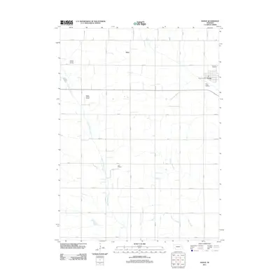
2011 Map of Dodge
USGS Topo · Published 2011About this map
Dodge serves as the primary hub for this agricultural region in the early 21st century, centered around its local grid and the Dodge Post Office. The landscape is defined by the drainage of East Fork Maple Creek and Silver Creek, which cut through a network of rural roads such as Co RD 8 and Road 17. Cultural and genealogical history is anchored by several rural burial grounds, including Saint Joseph Cemetery and Immanuel Cemetery near the main settlement, as well as S S Peter and Paul Cemetery and Tabor Cemetery positioned further out in the township. The presence of the Dostal-Bradley Airport west of town reflects the continued importance of local aviation in Nebraska's farming communities. To the north, the small community of Olean remains a named landmark within the systematic grid of county roads.
Find a feature on this map
31 named features on this map. Tap any name to fly to it.
Don’t see what you’re looking for? This feature index may not catch every label — zoom into the map to look around manually.
Map Details
Editions of this 2011 Dodge Map
This is the sole edition of this map. No revisions or reprints were ever made.
Other maps of this area

1955 · Fremont
USGS Topo · 1:250,000

1957 · Fremont
USGS Topo · 1:250,000

1958 · Fremont
USGS Topo · 1:250,000

1966 · Monterey
USGS Topo · 1:24,000

1966 · Webster
USGS Topo · 1:24,000

1966 · Snyder
USGS Topo · 1:24,000

1966 · Aloys
USGS Topo · 1:24,000

1966 · Clarkson
USGS Topo · 1:24,000
1966 · Stanton SE
USGS Topo · 1:24,000

1966 · Dodge SW
USGS Topo · 1:24,000