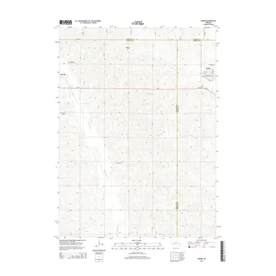
2014 Map of Dodge
USGS Topo · Published 2014About this map
Dodge serves as the primary hub in this agricultural landscape at the tri-county corner where Colfax, Cuming, and Dodge counties meet. The village's traditional grid, featuring streets like Ash St and Front St, is framed by agricultural lands drained by the winding E Fork Maple Cr and Silver Cr. Farther west, the community of Howells sits along the map's edge, connected to its neighbors by Ne-91 and Highway 91.
Find a feature on this map
53 named features on this map. Tap any name to fly to it.
Don’t see what you’re looking for? This feature index may not catch every label — zoom into the map to look around manually.
Map Details
Editions of this 2014 Dodge Map
This is the sole edition of this map. No revisions or reprints were ever made.
Other maps of this area

1955 · Fremont
USGS Topo · 1:250,000

1957 · Fremont
USGS Topo · 1:250,000

1958 · Fremont
USGS Topo · 1:250,000

1966 · Monterey
USGS Topo · 1:24,000

1966 · Webster
USGS Topo · 1:24,000

1966 · Snyder
USGS Topo · 1:24,000

1966 · Aloys
USGS Topo · 1:24,000

1966 · Clarkson
USGS Topo · 1:24,000
1966 · Stanton SE
USGS Topo · 1:24,000

1966 · Dodge SW
USGS Topo · 1:24,000