
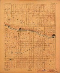
1892 Map of Dodge
USGS Topo · Published 1892This historical map portrays the area of Dodge in 1892, primarily covering Gray County as well as portions of Hodgeman County and Ford County. Featuring a scale of 1:125000, this map provides a highly detailed snapshot of the terrain, roads, buildings, counties, and historical landmarks in the Dodge region at the time. Published in 1892, it is one of 4 known editions of this map due to revisions or reprints.
Find a feature on this map
27 named features on this map. Tap any name to fly to it.
Don’t see what you’re looking for? This feature index may not catch every label — zoom into the map to look around manually.
Map Details
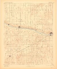
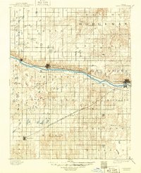
Editions of this 1892 Dodge Map
4 editions found
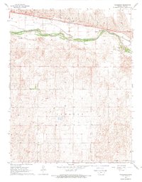
Historical Maps of Sears Through Time
10 maps found
1892 Dodge
Gray County, KS
1968 Charleston
Gray County, KS
1968 Cimarron NE
Gray County, KS
1968 Cimarron NW
Gray County, KS
1968 Montezuma NW
Gray County, KS
1968 Pierceville NE
Gray County, KS
1969 Copeland NE
Gray County, KS
1969 Copeland SE
Gray County, KS
1969 Haggard
Gray County, KS
1969 Montezuma SE
Gray County, KS