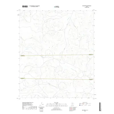
2019 Map of Dog Creek SW
USGS Topo · Published 2019About this map
W Rocky Cr and Little Mulberry Cr define the drainage patterns of this high plains landscape within Tom Green County. This 2019 survey captures a sparsely populated region where the topography is primarily shaped by seasonal watercourses like Dry Cr and Dog Cr. The map illustrates the administrative intersection of West Texas, specifically where the Sterling Co Tom Green Co and Tom Green Co Irion Co lines meet. A network of rural connectors, including FM 2014 and several county roads such as Co RD 118-P, provides the primary infrastructure through the rolling breaks and plateaus. For researchers, the map offers a precise view of the modern cattle-ranching landscape and the preservation of specific county-maintained thoroughfares across these three adjoining jurisdictions.
Find a feature on this map
10 named features on this map. Tap any name to fly to it.
Don’t see what you’re looking for? This feature index may not catch every label — zoom into the map to look around manually.
Map Details
Editions of this 2019 Dog Creek SW Map
This is the sole edition of this map. No revisions or reprints were ever made.
Other maps of this area

1895 · Sherwood
USGS Topo · 1:125,000

1921 · Ketchum Mountain
USGS Topo · 1:62,500

1923 · Ketchum Mountain
USGS Topo · 1:62,500

1954 · San Angelo
USGS Topo · 1:250,000

1958 · San Angelo
USGS Topo · 1:250,000

1965 · San Angelo
USGS Topo · 1:250,000

1972 · Arden
USGS Topo · 1:24,000

1972 · Dog Creek NE
USGS Topo · 1:24,000

1972 · Wallace Draw
USGS Topo · 1:24,000

1972 · Dog Creek SW
USGS Topo · 1:24,000