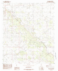
1985 Map of Dog Lake
USGS Topo · Published 1985About this map
Mescalero (The Caprock) Ridge dominates the topography of this corner of the Permian Basin, marking a dramatic escarpment that separates high mesas from the low-lying Querecho Plains below. This 1985 provisional study captures a landscape defined by intensive energy extraction and specialized land use, where multiple unnamed roads and trails snake between the Oil Field operations and the Graham Field. Significant industrial infrastructure is noted, including a Pumping Sta and various Gravel Pits, which supported the development of the region's oil and gas network. The namesake Dog Lake sits in the northwest, a topographic depression typical of the high plains of Lea County during the mid-1980s.
Find a feature on this map
8 named features on this map. Tap any name to fly to it.
Don’t see what you’re looking for? This feature index may not catch every label — zoom into the map to look around manually.
Map Details
Editions of this 1985 Dog Lake Map
This is the sole edition of this map. No revisions or reprints were ever made.
Other maps of this area

1942 · Clayton Basin
USGS Topo · 1:62,500

1943 · Clayton Basin
USGS Topo · 1:62,500

1954 · Hobbs
USGS Topo · 1:250,000

1958 · Hobbs
USGS Topo · 1:250,000

1962 · Buckeye
USGS Topo · 1:62,500

1963 · Laguna Gatuna
USGS Topo · 1:62,500

1963 · Maljamar
USGS Topo · 1:62,500

1984 · Ironhouse Well
USGS Topo · 1:24,000

1984 · Laguna Gatuna NW
USGS Topo · 1:24,000
1985 · Buckeye NW
USGS Topo · 1:24,000