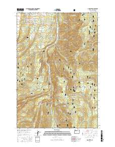
2017 Map of Dog River
USGS Topo · Published 2017About this map
The Upper Hood River Valley and the eastern slopes of the Cascade Range define this landscape within the Mount Hood National Forest. The E Fork Hood River serves as the primary drainage, flanked by significant elevation markers such as Bluegrass Ridge and Shellrock Mtn. This terrain is characterized by its high-altitude meadows and varied water sources, including Tamanawas Falls and numerous named springs like Shinners English Spring and Blue Bucket Spring.
Find a feature on this map
65 named features on this map. Tap any name to fly to it.
Don’t see what you’re looking for? This feature index may not catch every label — zoom into the map to look around manually.
Map Details
Editions of this 2017 Dog River Map
This is the sole edition of this map. No revisions or reprints were ever made.
Other maps of this area

1924 · Mount Hood
USGS Topo · 1:125,000

1926 · Hood River
USGS Topo · 1:125,000

1927 · Mount Hood
USGS Topo · 1:125,000

1929 · Hood River
USGS Topo · 1:125,000

1930 · Dufur
USGS Topo · 1:125,000

1934 · Dufur
USGS Topo · 1:125,000

1934 · The Dalles
USGS Topo · 1:125,000

1953 · The Dalles
USGS Topo · 1:250,000

1956 · The Dalles
USGS Topo · 1:250,000

1957 · The Dalles
USGS Topo · 1:250,000