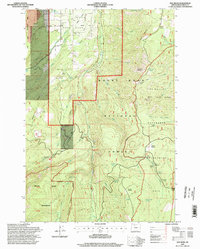
1996 Map of Dog River
USGS Topo · Published 1998About this map
Upper Hood River Valley terrain dominates this 1990s U.S. Forest Service study, illustrating the complex infrastructure required for high-elevation water management and recreation. The eastern portion of the map is defined by the Watershed Management Unit, which includes The Dalles City Waterworks and a series of gaging stations along the South Fork Mill Creek. This area provides a clear look at how glacial melt from features like the Newton Clark Glacier is captured and diverted through an intricate system of flumes and ditches, including the Volmer Ditch and Glacier Ditch.
Find a feature on this map
62 named features on this map. Tap any name to fly to it.
Don’t see what you’re looking for? This feature index may not catch every label — zoom into the map to look around manually.
Map Details
Editions of this 1996 Dog River Map
This is the sole edition of this map. No revisions or reprints were ever made.
Other maps of this area

1924 · Mount Hood
USGS Topo · 1:125,000

1926 · Hood River
USGS Topo · 1:125,000

1927 · Mount Hood
USGS Topo · 1:125,000

1929 · Hood River
USGS Topo · 1:125,000

1930 · Dufur
USGS Topo · 1:125,000

1934 · Dufur
USGS Topo · 1:125,000

1934 · The Dalles
USGS Topo · 1:125,000

1953 · The Dalles
USGS Topo · 1:250,000

1956 · The Dalles
USGS Topo · 1:250,000

1957 · The Dalles
USGS Topo · 1:250,000