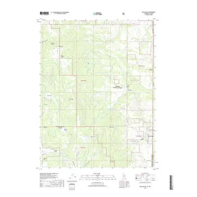
2018 Map of Dog Valley
USGS Topo · Published 2018About this map
Verdi sits at the eastern edge of the Sierra Nevada, where the High Sierra terrain gives way to the high desert along the California-Nevada border. This area is characterized by a series of high mountain valleys including Jones Valley, Hoke Valley, and Sardine Valley, all situated between the Verdi Range and the Bald Mountain Range. A historical transportation corridor is evident through the path of Henness Pass Rd, a significant mid-19th-century route for freight and emigrants during the mining rushes. High points like Babbitt Peak and Peavine Mountain overlook the drainage basins of Dog Cr and Merrill Cr. These watersheds are protected within the Tahoe National Forest and Toiyabe National Forest, showing a landscape managed for forest resources and preservation at the start of the 21st century.
Find a feature on this map
46 named features on this map. Tap any name to fly to it.
Don’t see what you’re looking for? This feature index may not catch every label — zoom into the map to look around manually.
Map Details
Editions of this 2018 Dog Valley Map
This is the sole edition of this map. No revisions or reprints were ever made.
Other maps of this area

1890 · Sierraville
USGS Topo · 1:125,000

1891 · Carson
USGS Topo · 1:125,000

1891 · Truckee
USGS Topo · 1:125,000

1891 · Reno
USGS Topo · 1:125,000

1892 · Sierraville
USGS Topo · 1:125,000

1893 · Carson
USGS Topo · 1:125,000

1893 · Truckee
USGS Topo · 1:125,000

1893 · Reno
USGS Topo · 1:125,000

1894 · Sierraville
USGS Topo · 1:125,000

1895 · Truckee
USGS Topo · 1:125,000