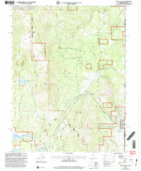
2000 Map of Dog Valley
USGS Topo · Published 2003About this map
Henness Pass Road and Emigrant Road cut through the high elevations of the Bald Mountain Range and Verdi Range, following historic transit corridors through the Sierra Nevada. This survey captures a landscape defined by the overlapping management of the Tahoe National Forest and Toiyabe National Forest, where high-altitude peaks like Babbitt Peak and Crystal Peak overlook the northern reaches of the Stampede Reservoir.
Find a feature on this map
41 named features on this map. Tap any name to fly to it.
Don’t see what you’re looking for? This feature index may not catch every label — zoom into the map to look around manually.
Map Details
Editions of this 2000 Dog Valley Map
This is the sole edition of this map. No revisions or reprints were ever made.
Other maps of this area

1890 · Sierraville
USGS Topo · 1:125,000

1891 · Carson
USGS Topo · 1:125,000

1891 · Truckee
USGS Topo · 1:125,000

1891 · Reno
USGS Topo · 1:125,000

1892 · Sierraville
USGS Topo · 1:125,000

1893 · Carson
USGS Topo · 1:125,000

1893 · Truckee
USGS Topo · 1:125,000

1893 · Reno
USGS Topo · 1:125,000

1894 · Sierraville
USGS Topo · 1:125,000

1895 · Truckee
USGS Topo · 1:125,000