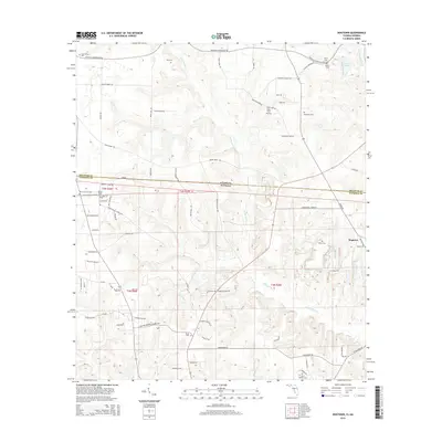
2015 Map of Dogtown
USGS Topo · Published 2015About this map
Willacoochee Creek and Betts Mill Creek define the drainage of this rural borderland between Georgia and Florida, where agricultural life and family legacy are deeply intertwined. The settlement of Dogtown sits on the eastern edge of the quadrangle, surrounded by several family-named burial grounds like Taylor Cem and Owens Cem. The landscape is etched with a network of local roads such as Bettstown Road and Donalson Farm Road, connecting isolated homesteads and small family farms. An interesting industrial and transport feature is the Viola Farm Airport, a private airstrip located near Viola Farm Road. The survey also documents the historical presence of several religious and community sites, including Mount Calvary Cem and Hebron Cem, providing a detailed record for genealogists tracing lineage across the Gadsden and Decatur county lines.
Find a feature on this map
82 named features on this map. Tap any name to fly to it.
Don’t see what you’re looking for? This feature index may not catch every label — zoom into the map to look around manually.
Map Details
Editions of this 2015 Dogtown Map
This is the sole edition of this map. No revisions or reprints were ever made.
Other maps of this area

1954 · Tallahassee
USGS Topo · 1:250,000

1955 · Bainbridge
USGS Topo · 1:62,500

1955 · Whigham
USGS Topo · 1:62,500

1955 · Mt Pleasant
USGS Topo · 1:24,000

1956 · Havana North
USGS Topo · 1:24,000

1956 · Dogtown
USGS Topo · 1:24,000

1959 · Tallahassee
USGS Topo · 1:250,000

1959 · Gretna
USGS Topo · 1:24,000

1959 · Quincy
USGS Topo · 1:24,000

1960 · Tallahassee
USGS Topo · 1:250,000