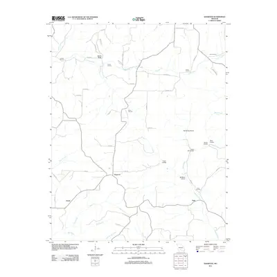
2011 Map of Dogwood
USGS Topo · Published 2011About this map
Finley Creek and Swan Creek carve a series of deep drainages across this Missouri Ozark landscape, which is defined by its small, dispersed settlements and numerous family cemeteries. Small crossroads like Dogwood and Tigris serve as anchor points for a network of county roads that navigate the complex topography of hollows and ridges. The presence of multiple burial grounds, including Goss Cemetery and the Philpott Cemetery, indicates a long-standing rural community structure where family lineages are tied to specific local landmarks. To the north, Sarvis Point overlooks the confluence of several small branches, while the southern reaches are marked by the winding paths of Bad Branch and Little Beaver Creek. The terrain is characterized by named features such as Big Spring Hollow and Red Bank Hollow, reflecting the region's characteristic karst-inflected drainage patterns.
Find a feature on this map
51 named features on this map. Tap any name to fly to it.
Don’t see what you’re looking for? This feature index may not catch every label — zoom into the map to look around manually.
Map Details
Editions of this 2011 Dogwood Map
This is the sole edition of this map. No revisions or reprints were ever made.
Other maps of this area

1936 · Ava
USGS Topo · 1:48,000

1937 · Bradleyville
USGS Topo · 1:48,000

1939 · Fordland
USGS Topo · 1:62,500

1942 · Fordland
USGS Topo · 1:62,500

1942 · Ava
USGS Topo · 1:62,500

1943 · Bradleyville
USGS Topo · 1:62,500

1945 · Ava
USGS Topo · 1:62,500

1945 · Harrison
USGS Topo · 1:250,000

1945 · Bradleyville
USGS Topo · 1:62,500

1949 · Harrison
USGS Topo · 1:250,000