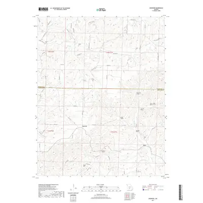
2017 Map of Dogwood
USGS Topo · Published 2017About this map
Dogwood and Tigris anchor this interior Ozark landscape, where the boundary between Webster and Douglas Counties cuts through a terrain of deep hollows and high ridges. The map records a dense network of family-named cemeteries, such as Philpott Cem, Silvey Cem, and Ellison Cem, which serve as vital markers of the area's genealogical history.
Find a feature on this map
72 named features on this map. Tap any name to fly to it.
Don’t see what you’re looking for? This feature index may not catch every label — zoom into the map to look around manually.
Map Details
Editions of this 2017 Dogwood Map
This is the sole edition of this map. No revisions or reprints were ever made.
Other maps of this area

1936 · Ava
USGS Topo · 1:48,000

1937 · Bradleyville
USGS Topo · 1:48,000

1939 · Fordland
USGS Topo · 1:62,500

1942 · Fordland
USGS Topo · 1:62,500

1942 · Ava
USGS Topo · 1:62,500

1943 · Bradleyville
USGS Topo · 1:62,500

1945 · Ava
USGS Topo · 1:62,500

1945 · Harrison
USGS Topo · 1:250,000

1945 · Bradleyville
USGS Topo · 1:62,500

1949 · Harrison
USGS Topo · 1:250,000