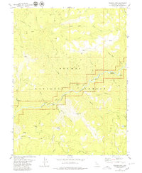
1979 Map of Dogwood Peak
USGS Topo · Published 1979About this map
The Middle Fork Feather River carves a deep path through the center of this terrain, designated as the Feather River Wild and Scenic corridor. This remote section of the Plumas National Forest in the late 1970s is defined by its steep river bars and isolated mining claims. Notable historical locations like Sherman Bar, Cleghorn Bar, and Carpenter Bar sit along the riverbanks, serving as focal points for exploration and activity in an otherwise high-elevation wilderness.
Find a feature on this map
42 named features on this map. Tap any name to fly to it.
Don’t see what you’re looking for? This feature index may not catch every label — zoom into the map to look around manually.
Map Details
Editions of this 1979 Dogwood Peak Map
3 editions found
Other maps of this area

1888 · Bidwell Bar
USGS Topo · 1:125,000

1891 · Bidwell Bar
USGS Topo · 1:125,000

1891 · Downieville
USGS Topo · 1:125,000

1893 · Bidwell Bar
USGS Topo · 1:125,000

1893 · Downieville
USGS Topo · 1:125,000

1895 · Bidwell Bar
USGS Topo · 1:125,000

1895 · Downieville
USGS Topo · 1:125,000

1896 · Downieville
USGS Topo · 1:125,000

1897 · Bidwell Bar
USGS Topo · 1:125,000

1897 · Downieville
USGS Topo · 1:125,000