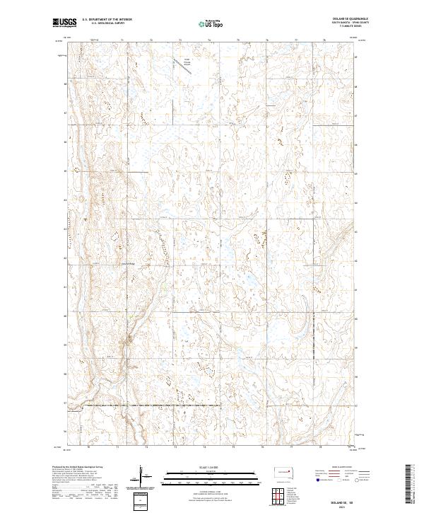
2021 Map of Doland SE
USGS Topo · Published 2021About this map
Doland Ridge forms the primary topographical feature of this Spink County landscape, rising subtly above the surrounding prairie. This area, largely defined by the Public Land Survey System grids of t116n r61w, t116n r60w, t115n r61w, and t115n r60w, reflects the enduring agrarian layout of the region. The map captures a section of South Dakota characterized by numerous small wetlands and basins interspersed with a precise network of rural section-line roads, including 405th Ave and 174th St. A notable human addition to the rural terrain is the Hofer Private Airport, located in the northern portion of the quadrangle. The intersection of local infrastructure, such as Co Rd 20 and Co Rd 1, illustrates the connectivity required for farming and local transport in this open country.
Find a feature on this map
23 named features on this map. Tap any name to fly to it.
Don’t see what you’re looking for? This feature index may not catch every label — zoom into the map to look around manually.
Map Details
Editions of this 2021 Doland SE Map
This is the sole edition of this map. No revisions or reprints were ever made.
Other maps of this area

1895 · Byron
USGS Topo · 1:125,000

1953 · Huron
USGS Topo · 1:250,000

1953 · Watertown
USGS Topo · 1:250,000

1954 · Huron
USGS Topo · 1:250,000

1956 · Lake Byron NW
USGS Topo · 1:24,000

1956 · Doland SW
USGS Topo · 1:24,000

1958 · Watertown
USGS Topo · 1:250,000
1971 · Doland NW
USGS Topo · 1:24,000
1971 · Doland
USGS Topo · 1:24,000
1971 · Doland SE
USGS Topo · 1:24,000
Featured Places
- Belle Plaine Township, SD
- Harrison Township, SD
- Capitola Township, SD
- Richfield Township, SD
- Spink County, SD