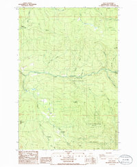
1986 Map of Dole
USGS Topo · Published 1986About this map
The East Fork Lewis River carves through this corner of Clark County, creating a central waterway marked by Horseshoe Falls. This mid-1980s landscape is defined by its recreation and conservation areas, notably Wormald State Park and the expansive Gifford Pinchot Nat For. The small settlement of Dole is situated near the southern center of the map, surrounded by a complex network of creeks including Rock Creek and Cedar Creek. To the north, the Yacolt Reservoir serves as a prominent landmark. The terrain is characterized by named heights such as Spotted Deer Mtn, Jack Mountain, and Squaw Butte. This provisional survey reflects a period when many timber-management areas were evolving into the campsites seen today, like Tarbell Campground and Sunset Campground, while active land use is indicated by various Borrow Pits and a Quarry scattered across the drainage basins.
Find a feature on this map
33 named features on this map. Tap any name to fly to it.
Don’t see what you’re looking for? This feature index may not catch every label — zoom into the map to look around manually.
Map Details
Editions of this 1986 Dole Map
2 editions found
Other maps of this area

1918 · Troutdale
USGS Topo · 1:62,500

1934 · Troutdale
USGS Topo · 1:48,000

1940 · Lookout Mtn
USGS Topo · 1:62,500

1941 · Yacolt
USGS Topo · 1:62,500

1941 · Camas
USGS Topo · 1:62,500

1942 · Camas
USGS Topo · 1:62,500

1948 · Vancouver
USGS Topo · 1:250,000

1950 · Vancouver
USGS Topo · 1:250,000

1950 · Vancouver
USGS Topo · 1:250,000

1953 · Lookout Mtn
USGS Topo · 1:62,500