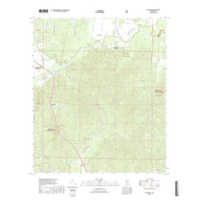
2018 Map of Doloroso
USGS Topo · Published 2018About this map
The Homochitto River meanders across the northern portion of this landscape, marking a transition from the bottomlands to the wooded hills of the Homochitto National Forest. This 2018 survey captures the rural character of the Adams and Wilkinson county line, where the small settlements of Doloroso and Possum Corner serve as local anchors. The map reveals an intricate network of waterways like Belmont Slough and Chase Bayou that weave through the low-lying terrain, while higher ground is accessed by historic plantation routes such as Commencement Plantation Rd and Springfield Pltn Rd. Genealogists will find notable burial sites including Bunch Cem and Geter Cem, which stand as enduring markers of the area's family histories and early landholdings in this corner of Mississippi.
Find a feature on this map
53 named features on this map. Tap any name to fly to it.
Don’t see what you’re looking for? This feature index may not catch every label — zoom into the map to look around manually.
Map Details
Editions of this 2018 Doloroso Map
This is the sole edition of this map. No revisions or reprints were ever made.
Other maps of this area

1936 · Woodville
USGS Topo · 1:62,500

1939 · Kingston
USGS Topo · 1:62,500

1953 · Natchez
USGS Topo · 1:250,000

1956 · Natchez
USGS Topo · 1:250,000

1958 · Woodville
USGS Topo · 1:62,500

1958 · Kingston
USGS Topo · 1:62,500

1959 · Natchez
USGS Topo · 1:250,000

1961 · Crosby
USGS Topo · 1:62,500

1961 · Gloster
USGS Topo · 1:62,500

1984 · Woodville
USGS Topo · 1:100,000