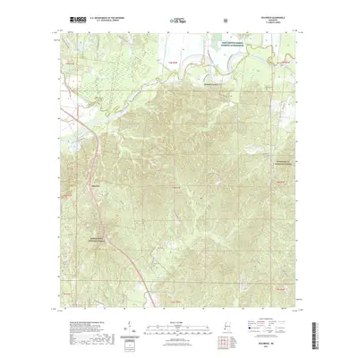
2021 Map of Doloroso
USGS Topo · Published 2021About this map
Doloroso sits along the southern edge of the Homochitto National Forest in a landscape defined by the winding course of the Homochitto River. This 2021 survey of Wilkinson and Adams Counties reveals a rural environment where land use remains closely tied to the water, from the complex drainage of Chase Bayou and Second Creek to the managed timberlands of the national forest.
Find a feature on this map
55 named features on this map. Tap any name to fly to it.
Don’t see what you’re looking for? This feature index may not catch every label — zoom into the map to look around manually.
Map Details
Editions of this 2021 Doloroso Map
This is the sole edition of this map. No revisions or reprints were ever made.
Other maps of this area

1936 · Woodville
USGS Topo · 1:62,500

1939 · Kingston
USGS Topo · 1:62,500

1953 · Natchez
USGS Topo · 1:250,000

1956 · Natchez
USGS Topo · 1:250,000

1958 · Woodville
USGS Topo · 1:62,500

1958 · Kingston
USGS Topo · 1:62,500

1959 · Natchez
USGS Topo · 1:250,000

1961 · Crosby
USGS Topo · 1:62,500

1961 · Gloster
USGS Topo · 1:62,500

1984 · Woodville
USGS Topo · 1:100,000