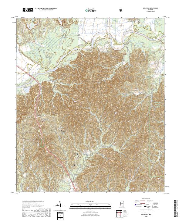
2024 Map of Doloroso
USGS Topo · Published 2024About this map
The Homochitto River meanders across the northern portion of this landscape, defining the transition between the lowlands and the densely wooded ridges of the Homochitto National Forest. This modern survey reveals a region deeply rooted in its agricultural past, with numerous roads such as Commencement Plantation Rd, Ellisie Plantation Rd, and Springfield Pltn Rd reflecting the historical land divisions of Wilkinson and Adams counties. Small communities like Doloroso and Possum Corner serve as focal points for local life, supported by spiritual centers such as the Free Spring Baptist Church. Genealogists will find significant value in the distribution of family and community burial grounds, including Free Spring Baptist Church Cem, Geter Cem, Bunch Cem, and Dawson Cem, which are scattered throughout the hills and creek valleys like Rolley Creek and Hurricane Creek.
Find a feature on this map
58 named features on this map. Tap any name to fly to it.
Don’t see what you’re looking for? This feature index may not catch every label — zoom into the map to look around manually.
Map Details
Editions of this 2024 Doloroso Map
This is the sole edition of this map. No revisions or reprints were ever made.
Other maps of this area

1936 · Woodville
USGS Topo · 1:62,500

1939 · Kingston
USGS Topo · 1:62,500

1953 · Natchez
USGS Topo · 1:250,000

1956 · Natchez
USGS Topo · 1:250,000

1958 · Woodville
USGS Topo · 1:62,500

1958 · Kingston
USGS Topo · 1:62,500

1959 · Natchez
USGS Topo · 1:250,000

1961 · Crosby
USGS Topo · 1:62,500

1961 · Gloster
USGS Topo · 1:62,500

1984 · Woodville
USGS Topo · 1:100,000