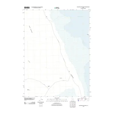
2011 Map of Dolphin Island West
USGS Topo · Published 2011About this map
The remote western shores of the Great Salt Lake define this high-desert landscape in Box Elder County. Dominating the western half of the map, the Hogup Mountains rise above the salt flats, with the seasonal drainage of Big Wash cutting through the terrain. Human presence is sparse, marked primarily by the isolated Youngs Corral and the utilitarian path of Hogup Mountain Rd, which skirts the edge of the wetlands.
Find a feature on this map
10 named features on this map. Tap any name to fly to it.
Don’t see what you’re looking for? This feature index may not catch every label — zoom into the map to look around manually.
Map Details
Editions of this 2011 Dolphin Island West Map
This is the sole edition of this map. No revisions or reprints were ever made.
Other maps of this area

1954 · Brigham City
USGS Topo · 1:250,000

1958 · Brigham City
USGS Topo · 1:250,000

1962 · Brigham City
USGS Topo · 1:250,000

1969 · Spring Bay SW
USGS Topo · 1:24,000

1969 · Dolphin Island West
USGS Topo · 1:24,000

1969 · Gunnison Island SW
USGS Topo · 1:24,000
1969 · Dolphin Island East
USGS Topo · 1:24,000

1969 · Hogup Ridge North
USGS Topo · 1:24,000

1969 · Hogup Bar
USGS Topo · 1:24,000
1969 · Crocodile Mtn SE
USGS Topo · 1:24,000