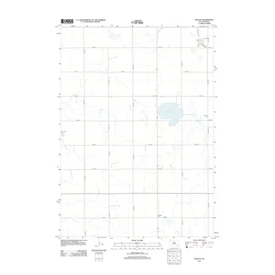
2012 Map of Dolton
USGS Topo · Published 2012About this map
Silver Lake dominates the central landscape of this rural South Dakota quadrangle, providing a significant hydrological anchor amidst a grid of agricultural section lines. The settlement patterns are defined by a meticulous network of roads, including 438th Ave and 273rd St, which navigate the prairie terrain. In the northeast, the small community of Dolton is oriented around its historical connection to the rail corridor, evidenced by Railroad St and Main St. Genealogical interest is concentrated in three distinct cemeteries—Kleinkassell Cem, Schartner Cem, and Tschetter Cem—which reflect the family legacies and early settlement history of Turner County. This 2012 survey illustrates the enduring rural character of the region, where the interplay of water bodies like Silver Lake and established road networks continues to shape the local geography.
Find a feature on this map
21 named features on this map. Tap any name to fly to it.
Don’t see what you’re looking for? This feature index may not catch every label — zoom into the map to look around manually.
Map Details
Editions of this 2012 Dolton Map
This is the sole edition of this map. No revisions or reprints were ever made.
Other maps of this area

1898 · Olivet
USGS Topo · 1:125,000

1898 · Parker
USGS Topo · 1:125,000

1899 · Alexandria
USGS Topo · 1:125,000

1955 · Sioux Falls
USGS Topo · 1:250,000

1957 · Wolf Creek
USGS Topo · 1:24,000

1958 · Sioux Falls
USGS Topo · 1:250,000

1964 · Canistota
USGS Topo · 1:24,000

1964 · Bridgewater East
USGS Topo · 1:24,000

1970 · Clayton NE
USGS Topo · 1:24,000

1970 · Freeman SE
USGS Topo · 1:24,000