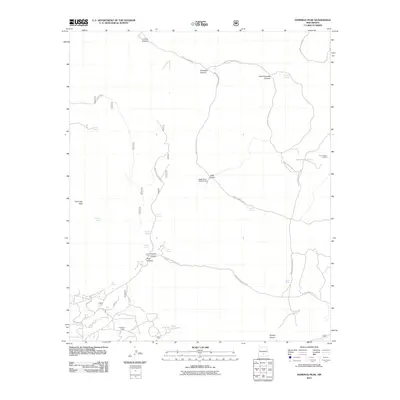
2011 Map of Domingo Peak
USGS Topo · Published 2011About this map
Coronado Lodge and the high ridges of the Sacramento Mountains define this 2011 survey of the Mescalero area. The landscape is characterized by a complex network of canyons, including Cuervo Canyon, Cold Canyon, and Apache Canyon, which provide natural drainage toward La Luz Creek in the south. This terrain is marked by essential water sources for ranching and wildlife, such as Patton Spring, Ransom Spring, and Seven Spring.
Find a feature on this map
38 named features on this map. Tap any name to fly to it.
Don’t see what you’re looking for? This feature index may not catch every label — zoom into the map to look around manually.
Map Details
Editions of this 2011 Domingo Peak Map
This is the sole edition of this map. No revisions or reprints were ever made.
Other maps of this area

1950 · Alamogordo
USGS Topo · 1:62,500

1950 · Mescalero
USGS Topo · 1:62,500

1952 · Cloudcroft
USGS Topo · 1:62,500

1954 · Carlsbad
USGS Topo · 1:250,000

1955 · Roswell
USGS Topo · 1:250,000

1958 · Carlsbad
USGS Topo · 1:250,000

1958 · Roswell
USGS Topo · 1:250,000

1962 · Roswell
USGS Topo · 1:250,000

1963 · Firman Canyon
USGS Topo · 1:24,000

1963 · Apache Summit
USGS Topo · 1:24,000