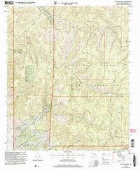
2004 Map of Domingo Peak
USGS Topo · Published 2006About this map
The Mescalero Apache Indian Reservation and Lincoln National Forest meet in this high-altitude corner of Otero County, where steep-walled drainage systems define the landscape. Water resources are the primary landmarks in this arid terrain, with numerous named points such as Nogal Spring, Eclipse Spring, and Maruche Lake providing critical landmarks for navigation and land use. The topography is dominated by dramatic elevation shifts, anchored by Domingo Peak and the operational Five Canyon Lookout Tower.
Find a feature on this map
49 named features on this map. Tap any name to fly to it.
Don’t see what you’re looking for? This feature index may not catch every label — zoom into the map to look around manually.
Map Details
Editions of this 2004 Domingo Peak Map
This is the sole edition of this map. No revisions or reprints were ever made.
Other maps of this area

1950 · Alamogordo
USGS Topo · 1:62,500

1950 · Mescalero
USGS Topo · 1:62,500

1952 · Cloudcroft
USGS Topo · 1:62,500

1954 · Carlsbad
USGS Topo · 1:250,000

1955 · Roswell
USGS Topo · 1:250,000

1958 · Carlsbad
USGS Topo · 1:250,000

1958 · Roswell
USGS Topo · 1:250,000

1962 · Roswell
USGS Topo · 1:250,000

1963 · Firman Canyon
USGS Topo · 1:24,000

1963 · Apache Summit
USGS Topo · 1:24,000